
Spring Break 2017 - Day 6: Lee's Ferry & Horseshoe Bend

- Day 6 -
Friday - April 7, 2017
Friday - April 7, 2017
Eager to try out the nearby two-mile Spencer Trail that switchbacks and climbs up the Vermillion Cliffs from the banks of the Colorado River at the site of Lee's Ferry and on up to a high plateau above, I awoke at 5 am and started hiking down the road for the trailhead. Along the way, the road crossed over the Paria River. It was pretty cool to think about what was upstream from there. More on that later, though.

Crossing over the Paria River

The Paria River, looking upstream
I had hoped to make it all the way up the Spencer Trail before sunrise, but that hope was vain. I did not account for the fact that due to Arizona time being an hour behind what Utah time was, the sun was to rise an hour sooner than what I expecting. I also did not account for the one and a half mile length of road between the campground and the trail itself. I had actually planned to just drive it, but in the interest of not wanting to wake up our youngest or anyone else still sleeping at our camp, I opted to use my feet to travel the road instead. Despite all that, I was still privileged to witness another beautiful sunrise.

Sunrise

Sunrise

Sunrise

Looking back west down the road

Looking northward from along the road
Just prior to the trailhead, I veered off down to the boat launch for a few moments to stand at the banks of the Colorado River.

On the banks of the Colorado River

Morning alpenglow
At the start of the trail, I spent a few more minutes looking over the historic pioneer structures and ruins that remained from when Lee's Ferry had operated from the late 1800's through the early 1900's.
Lee's Ferry is the site of an old pioneer ferry that used to be the only way across the Colorado River for hundreds of miles. It was established by Mormon pioneer, John D. Lee, in the early 1870's to facilitate emigrating Mormon pioneers seeking to settle further south in Arizona which ultimately led to the formation communities including Snowflake and Mesa. In later years, many other travelers would rely on the ferry in their journeys across the mighty Colorado River. Unfortunately, Lee was also a major participant in the controversial Mountain Meadows Massacre in Southern Utah several years prior in 1857. Soon after setting up the ferry, he was ultimately arrested, tried and prosecuted, having been found guilty of being the leader who carried out the heinous attack with the aid of several other Mormon men and some Native Americans that slew an innocent band of emigrant men, women, and children in the deserts of Southern Utah as they were making their way from Arkansas to California and the West Coast. Lee was the only one to be tried and was ultimately executed by firing squad at the site of the Mormon Meadows Massacre.
Lots of debate continues this day about who really proposed the attack with many believing it was then LDS (Mormon) Church President, Brigham Young himself who commanded it. In hindsight it's easy to judge and interpret the tragic event as a cruel, senseless, cowardly, and dastardly act. The reality is that, as with many other historical events, there are so many conflicting accounts, statements, journal entries, and other records that it is hard to confidently draw any accurate and provable conclusion as to who was ultimately responsible for perpetrating, condoning, and calling for the massacre.
It is also hard to draw any irrefutable conclusion about the motives behind it and each of its participants because mixed emotions were no doubt running high among many of the local Mormon settlers at the time. There was heightened hysteria created by the ongoing "Utah War" at the time. Added to that was some animosity harbored by some against the state of Arkansas where Mormon leader Parley Pratt had recently been murdered, likely due to a lack of context and information about the circumstances that led to his murder. Many of the Mormon settlers had also recently fled to Utah and the intermountain west to escape the mobs, violence, and other cruel forms of persecution and turmoil that had followed them throughout the East. Given the events in their recent history including some massacres that had been inflicted upon themselves and their families, and with seemingly nowhere else to flee to and resettle, it would have been very easy for some to feel like their backs were up against a wall. Therefore, it should be understandable, albeit not necessarily excusable, why many of the Mormon settlers involved in the affair could have distrusted any such large "outsider" groups entering their newfound and recently settled territory and thus perceive them as a threat. In the end, I think the Mountain Meadows Massacre was an ill-conceived attack that resulted from some terrible misunderstandings, some preconceived judgements, and ultimately became a tragedy for all involved.
Regardless of motives or whether he truly orchestrated the massacre for which he was executed, John D. Lee and the ferry he set up on the banks of the Colorado River in what is now Northern Arizona had a significant role on the history and settlement of that part of the American frontier and the southwest deserts. The site of the ferry now serves as a launch site for recreational rafting, fishing boats, and a junction of hiking trails.

Historic marker

Lee's Ferry Ruins

Lee's Ferry Ruins

Lee's Ferry Ruins
After passing through the ruins, I continued on up the trail and soon started rising high above the Colorado.

On the Spencer Trail looking up the Colorado River

Climbing high up the cliffs

Spencer Trail
About 3/4 of a mile up, the trail became quite exposed. On the left was a short and very steep slide down to a cliff band resulting in a vertical drop of at least 75 feet and on the right was a wall of sandstone clumps and clay. The trail itself was just shy of being a foot wide, or so it seemed. A slip, bump, trip, or tumble at this point, could have easily been fatal, sending myself down the slope and off the cliff.

Narrow and exposed
As one who can have a real fear of heights at times, it was a little nerve-wracking, but I pressed on, slow and steady, as I side stepped it up around the next corner. Given the conditions on either side of the trail, I felt claustrophobic the whole way through this section. Fortunately, it was a very short little stretch and the trail soon led me back to where I had much more 'breathing room'.

Looking up the Colorado River

Looking down the Colorado River

Navajo Bridge and Marble Canyon

Campground

Lee's Ferry

Desert Primrose
I was not looking forward to having to negotiate the exposed spot again, but it came and passed without any incident. On my way down, some boaters could be seen launching off down at the river, no doubt heading upstream to do some fishing.

Boat on Colorado River

Prickly Pear near Colorado River

Prickly Pear
The Spencer Trail is an old mule path named after Charles H Spencer who briefly ran a gold mining operation at Lee's Ferry in the early 1900's along the banks of the river. Part of that operation relied on a steamboat to haul coal up and down the river. All that remains of the steamboat now is the boiler that sits just below the trail at the edge of the river where a flood in 1921 had sunk the boat.

Spencer Steamboat ruin
On my way back up the road, I stopped at the Paria River and went upstream a bit to Lonely Dell Ranch, which was also set up by John D. Lee and served as a homestead for his family.

Paria River

Lonely Dell Ranch
Soon, I was back camp where we packed up and got going again.

Our Camp
Before heading out from Lee's Ferry, I drove the family back up to the trailhead so they could stand at the edge of the Colorado River and see all the old structures nearby.

Touching the Colorado River

Family photo at Lee's Ferry ruins
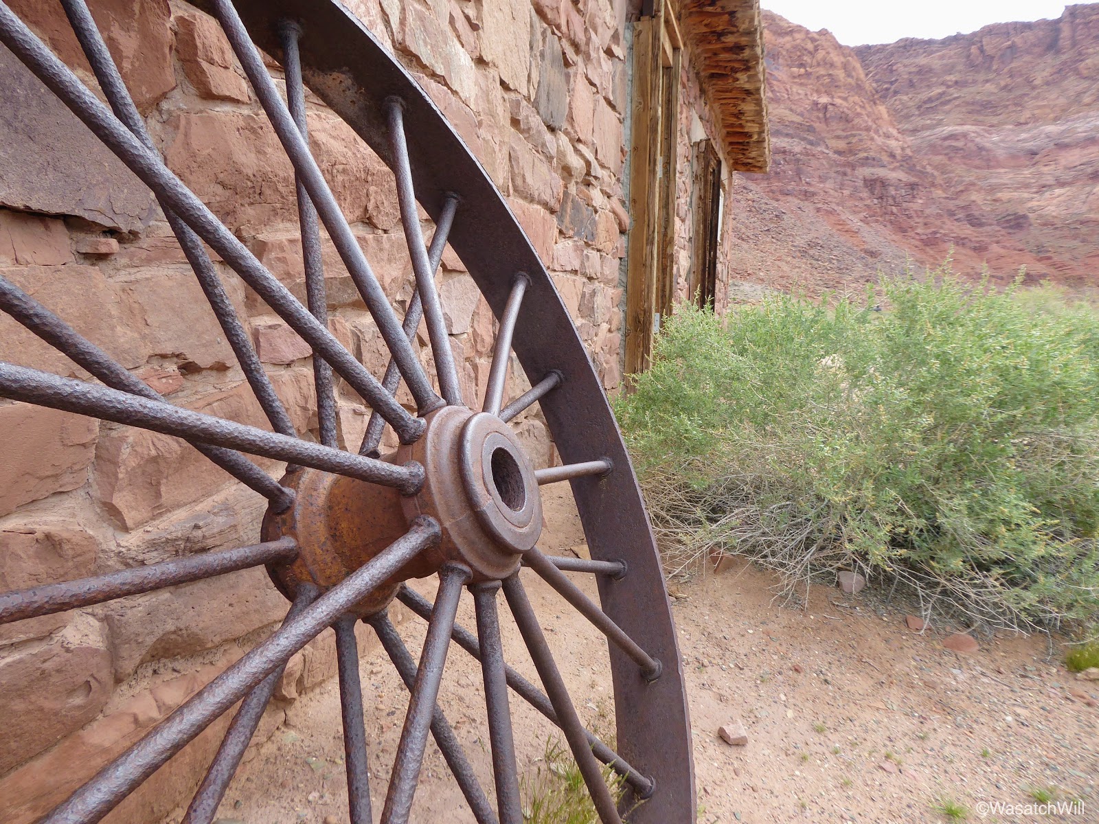
Old wheel at Lee's Ferry ruins
On the way out from Lee's Ferry, we made another quick stop at the Navajo Bridge.

New Navajo Bridge

Marble Canyon

Checking out Marble Canyon from old Navajo Bridge

The kids on the old Navajo Bridge
From Navajo Bridge and Marble Canyon, the faster route back into Utah and up to Torrey for the night would have been to head west toward Jacobs Lake and then northward up through Kanab from there. But since we were so close to Horseshoe Bend, a scenic point where the Colorado River makes a sharp bend, we opted to go to other way to check that out.
I knew Horseshoe Bend was popular among photographers, especially around sunrise and sunset, but I did not anticipate much more than a dozen other vehicles being at the trailhead since it was closer to the middle of the day. I was wrong. I did not know just how big the trailhead parking lot really was and when we arrived, it felt like we were back at the zoo. There was literally close to a couple hundred cars and it showed on the trails with hundreds of people parading up and down the short trail and flocked all around the viewpoint. Still, we found ourselves a parking spot and joined the throngs of others on the trail.

Staring up the trail to Horseshoe Bend

On the trail to Horseshoe Bend

Horseshoe Bend

Will overlooking Horseshoe Bend

The kids looking out at Horseshoe Bend

The kids looking out at Horseshoe Bend

Everett opted for a nap the whole time
After Horseshoe Bend, we were all very hungry and drove another 5 minutes down into Page for some lunch. From Page we drove on over Glen Canyon, pulling over to have a quick look at the dam before moving on to Kanab.

Glen Canyon Dam
Had we more time and energy, we would have pulled over for another hike up to a little area called the Toadstools before reaching Kanab. Instead, we all agreed to keep on going and save the Toadstools for another day. Just outside of Kanab, we did pull over at a place called Moqui Cave.
Again, had we more time, we may have paid the admission to tour the little museum that it has, but instead, just kept to the outside for a few minutes to stretch and loosen our legs a bit. The kids were particularly fond of the dinosaur statue and some dinosaur footprints fossilized into a boulder out on display.

Dinosaur at Moqui Cave

Lennox sizing up a dinosaur track

Raylee sizing up a dinosaur track
From Moqui Cave we headed straight up for Torrey where we reunited with our dog, Sophie, and spent our final night of the trip at the home of Jessica's parents.


Leave a Comment