
Provo Peak

Since I live near the base of Slate Canyon and the Y sits right next to Slide Canyon just north of Slate, I was familiar with a route that would allow us to make a full loop with the trip, or at least very close to a full loop with this particular trip. We determined it would be best to start up Slate Canyon and finish the trip coming down Slide Canyon. We opted to set up a shuttle with Steve's car parked up at the Y trailhead to spare ourselves of what would be another 2 miles of hot afternoon hiking exposed to the sun if we were to make it a complete loop.
We convinced Larry to finally commit to it the week prior and got a neighbor of mine, James, to join along.
- Day 1 -
Thursday - July 2, 2015
Thursday - July 2, 2015
We all met at my place early in the evening where we took my car up to Slate Canyon Trailhead. Normally, I would just go around the block, cross the road, and hike a foothill trail up to the trailhead, but doing so adds about another mile and we wanted to save ourselves from any unnecessary hiking in the heat of the sun.
It was just after 6 pm when we started up Slate Canyon. Fortunately, that also meant the sun was getting lower in the sky and we'd have ample shade as we got higher up in the canyon.

Along the way, we'd stop for a few short rests including a spot that had some raspberry bushes. We helped ourselves to the few ripe ones that we could find.

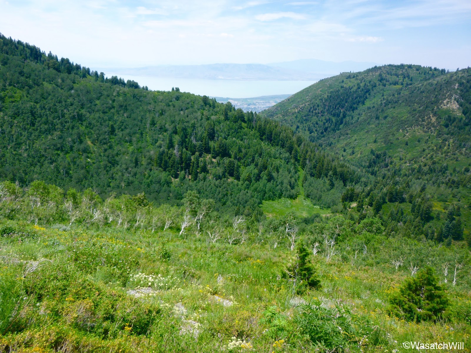
Eventually we reached the fork at the top of Slate Canyon. You can take a right there and go about a quarter mile up to Boardman Spring. We still had plenty of water, so we kept to the left with our destination for the night being northward at the top of Slide Canyon. We paused for another rest in the meadow just after the left fork.


Here, James discovered a spring I had not noticed before, despite being through the area a few different time before. It is not marked or labeled on any map I've seen. It was still cold and refreshing to have a little drink and cool our heads in.

It would have been tempting to just camp there, but we wanted to finish down Slide Canyon and the Y trail the next day and the meadow above Slide Canyon was a bit closer to the trail we needed to take that would get us over to Provo Peak the next morning.
So we put our packs back on and made the final push up and over to Slide Canyon. The sun was setting as we arrived in the meadow atop Slide Canyon, setting the clouds aglow.

We set up camp, made a fire, had something to eat, and shared some stories before retiring for the night.

- Day 1 -
Friday - July 3, 2015
Friday - July 3, 2015
The full moon had kept the area well lit for the entire night. I had a good night of relaxation in my hammock, but it did get a bit cooler than I had expected. Upon waking, James informed us that he was awakened to the sounds of hoofs wandering about the meadow during the night. We were confident it was a moose I had seen down in the nearby trees the day before, when I had done a preliminary recon hike of the whole loop, save the Provo Peak section, in order to ensure the little trickling spring in the meadow near our camp was still running. Because the sound of the hoofs came quite close and he was cowboy camping under the stars, James reported that he wasn't able to get back into a deep sleep thereafter. I know I wouldn't have either.


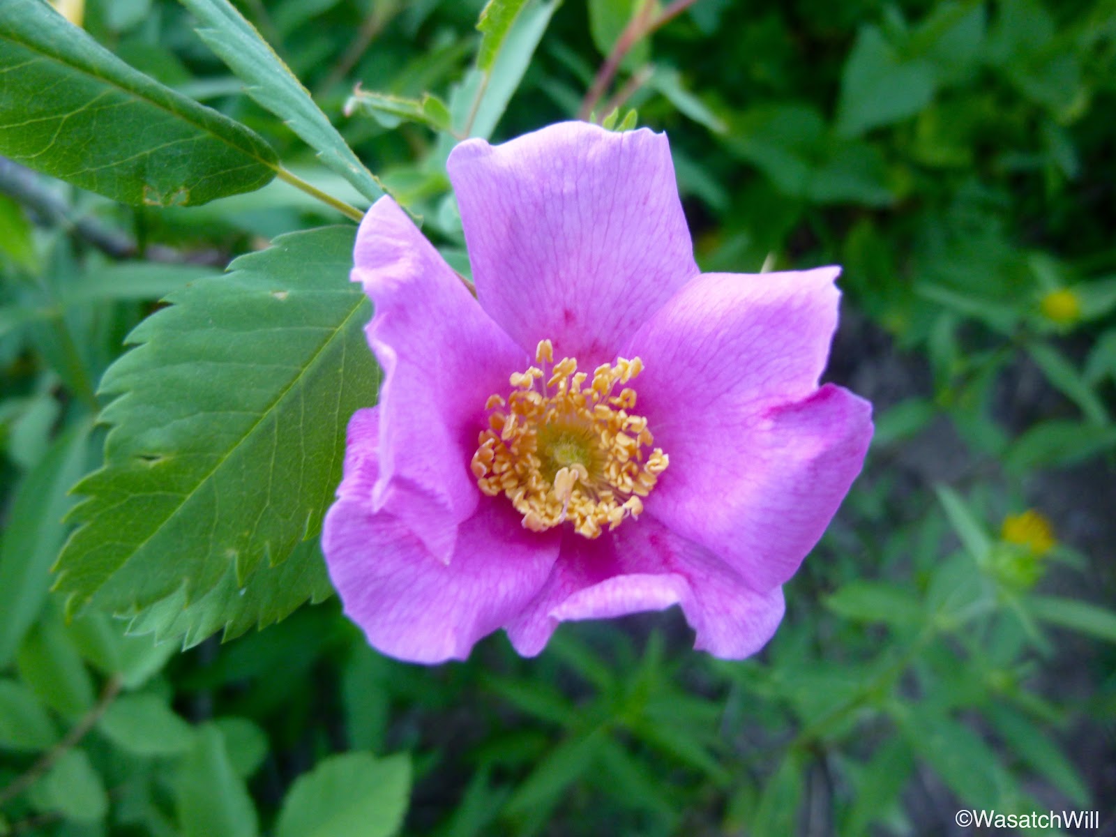
A variety of flowers were abundant along the whole route.


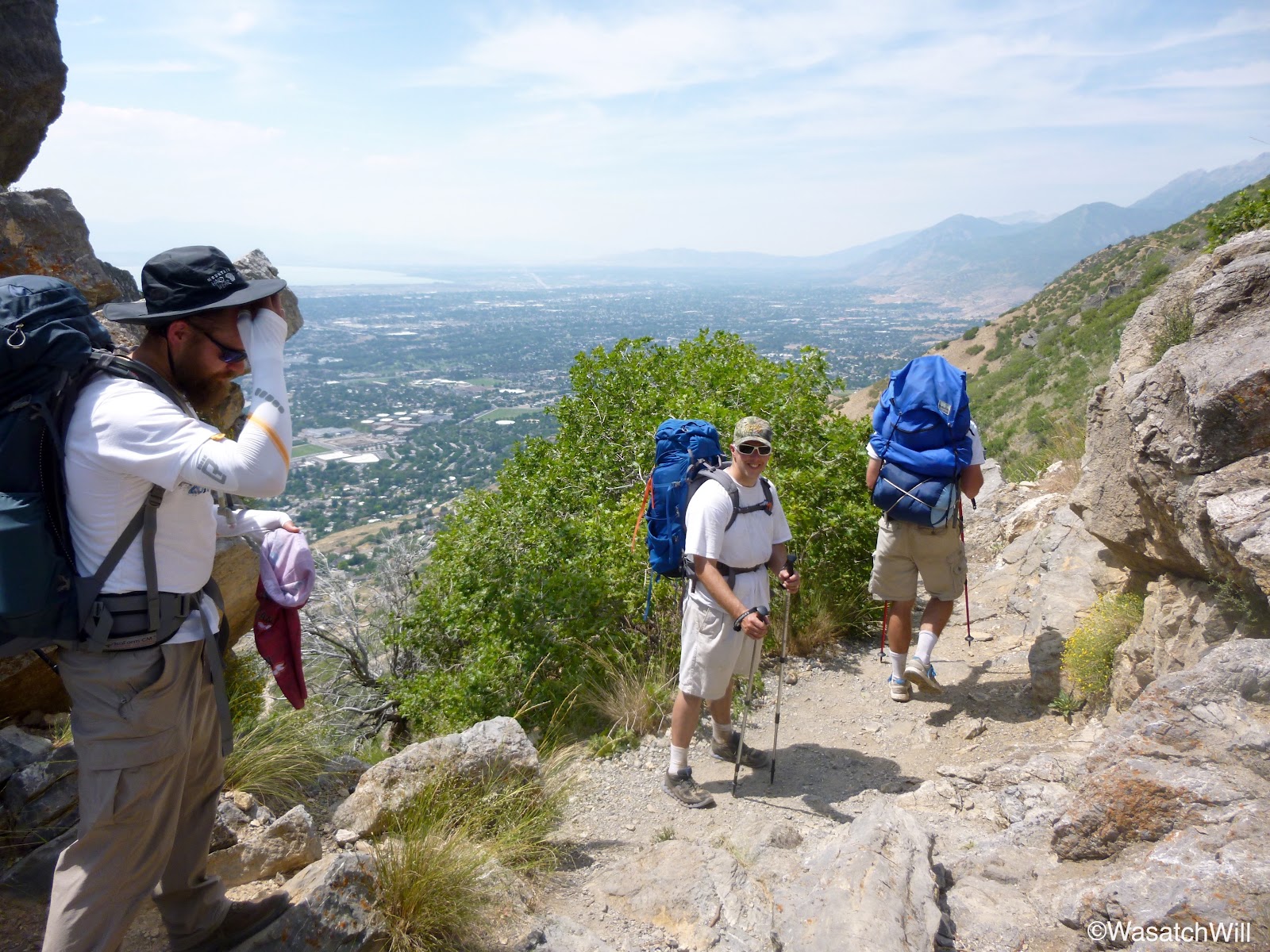
Before long, we reached the end of the one mile long trail #62 where it meets up with Squaw Peak Road. There is a bit of a parking area here that serves as the trailhead for the west ridge of Provo Peak. All we had to do was cross the road and then we were on our way up.


Not only did he eventually catch up to and pass them, he also passed me just moments away from the summit. James was ahead enough to be the only one to make it to the top without getting picked off.
As I arrived at the summit, Davy was taking a short breather and taking a few pictures while James questioned if a peak just to the east had a name and I told him it was East Provo Peak. At that point, Davy joined in the conversation for a moment and said something like, "Yep, pretty scary to get to."


With the sun now fully up, the slopes were even more colorful on the descent.

On our return to camp along trail #62, we took one final look back at Provo Peak. Doesn't look so bad from a distance, does it?

Several minutes later, our camp was back in view down in our little meadow below. With the heat starting to really bear down on us and our water bottles nearly empty, we were very much looking forward to a refill at the spring.


After arriving back at the meadow, refilling and refreshing at the spring, and gathering up our gear, we set off down Slide Canyon to finish the trip. By now, we were running a couple hours late on our schedule and some of us had wives counting on us to be home soon so we hastily moved down.
When we arrived at the mouth of Slide Canyon, we could look down and see Seven Peaks Waterpark. With the heat of the day beginning to peak now, it was like viewing a forbidden oasis. What fun it would have been if there was a waterslide right then and there for us to jump on and take us the rest of the way down.

Instead, we had to finish the hike the hard way.


We took one last break before descending the Y trail. With the mid-afternoon heat and absolutely no shade, it would become the hardest part of the hike. The sun beat down upon us mercilessly and our energy stores were zapped pretty good.


Nevertheless, we made it down to Steve's car down in the trailhead lot. Had it been cooler out, I would have been tempted to continue on to Slate Canyon via the Bonneville Shoreline Trail to make it a complete loop. Instead, I happily accepted the shuttle ride back to Slate Canyon to pick up my car. We celebrated the end of the trip with a customary cold drink.
Steve and I would have it easy from there with the rest of the weekend to relax. James and Larry had to take what was left of the day to recover for a 5K and 10K, respectively, the following morning. That they both did and each of them made it through their race.

After breakfast and cleaning up our camp, it was time to make our way up and over to Provo Peak. We hid all that we didn't need for the summit hike in a little stand of trees near the meadow, filled up our water bottles at the nearby spring, and set off.

We had to backtrack our footsteps from the night before, almost a half mile, to get back to the junction with trail #62 which would lead us up and over to Squaw Peak Road and the base of Provo Peak.

A variety of flowers were abundant along the whole route.


Before long, we reached the end of the one mile long trail #62 where it meets up with Squaw Peak Road. There is a bit of a parking area here that serves as the trailhead for the west ridge of Provo Peak. All we had to do was cross the road and then we were on our way up.


Little did we know that about halfway up the peak, we'd look back and find that the great Davy Crockett was on our heels. He is an ultra-running legend in these parts who has done some pretty intense distance runs and races across all sorts of challenging terrain. I jokingly yelled out to Larry and Steve that they couldn't let him pass them. The race was on!
 |
| Davy Crockett closing in on us |
As I arrived at the summit, Davy was taking a short breather and taking a few pictures while James questioned if a peak just to the east had a name and I told him it was East Provo Peak. At that point, Davy joined in the conversation for a moment and said something like, "Yep, pretty scary to get to."
 |
| A video still summit selfie, a photobomb by Davy Crockett, or both? |
And just like that, he was off down the ridge making his way toward it.
I didn't identify him at the time, but had I known it was Davy Crockett doing what he was doing, we would have provided him some additional encouragement. It was only after a post on Facebook and some conversation with him there that I learned he was in progress of completing a grueling and incredibly challenging feat: attempting to summit Utah County's eight highest peaks in one day, all rising over 11,000 feet.
Provo Peak was his 3rd of the day already, having done Nebo and North Nebo. After Provo and East Provo, he would go on to North Timpanogos, Timpanogos, South Timpanogos, and Box Elder. It's neat to know we got to witness him in the act of completing his historical ultra adventure. He didn't quite complete the feat in 24 hours, but my hat is off to him for still doing it all in one stretch. And I thought I was tough at one point in my life when I had been a cross country runner and had run a couple full marathons. It is flat out amazing what others can train their bodies to endure.
You can see pictures and read all about the details of his epic endeavor and achievement, including a mention of our group, on his own blog post here.
It was quite a hike for all of us in our group, gaining over 2700 feet in just 1.5 miles from the base, but that effort pales in comparison to Crockett's. We would stay a little longer on the peak to soak up the views, snap some more pictures and video, and of course refuel with some snacks and liquids before heading on down back to our camp.


|
| Left to Right: James, Steve, Will (me), & Larry |
Since it was Independence Day weekend, I had to break out the red, white, and blue. I'm grateful to not only live upon a land full of beautiful wilderness and landscapes, but also a land of liberty and freedom.

With the sun now fully up, the slopes were even more colorful on the descent.

On our return to camp along trail #62, we took one final look back at Provo Peak. Doesn't look so bad from a distance, does it?

Several minutes later, our camp was back in view down in our little meadow below. With the heat starting to really bear down on us and our water bottles nearly empty, we were very much looking forward to a refill at the spring.

After arriving back at the meadow, refilling and refreshing at the spring, and gathering up our gear, we set off down Slide Canyon to finish the trip. By now, we were running a couple hours late on our schedule and some of us had wives counting on us to be home soon so we hastily moved down.
When we arrived at the mouth of Slide Canyon, we could look down and see Seven Peaks Waterpark. With the heat of the day beginning to peak now, it was like viewing a forbidden oasis. What fun it would have been if there was a waterslide right then and there for us to jump on and take us the rest of the way down.

Instead, we had to finish the hike the hard way.


We took one last break before descending the Y trail. With the mid-afternoon heat and absolutely no shade, it would become the hardest part of the hike. The sun beat down upon us mercilessly and our energy stores were zapped pretty good.
 |
| Looking down the Y |

Steve and I would have it easy from there with the rest of the weekend to relax. James and Larry had to take what was left of the day to recover for a 5K and 10K, respectively, the following morning. That they both did and each of them made it through their race.
 Final Thought
A water filter system is not necessary for this hike. With at least three reliable springs up Slate Canyon and two more that can be found in Slide Canyon plus a water fountain at the Y trailhead, clean and fresh water is plentiful along this route. In fact, these are the only water sources.


Thanks
ReplyDelete