
Slide Canyon - Slate Canyon Loop and Provo Peak

- Day 1 -
Tuesday - June 6, 2017
Tuesday - June 6, 2017
From my house, I took a shortcut through the Utah State Hospital grounds. On the grounds, I passed through what is known to the neighborhood as the 'Castle Amphitheater'. It was built in 1936-37 and was originally intended to be a part of a greater recreation center. It stands as one of 230 public works buildings that were constructed in Utah as part of a New Deal program during the Great Depression.

Outside the 'Castle' Amphitheater
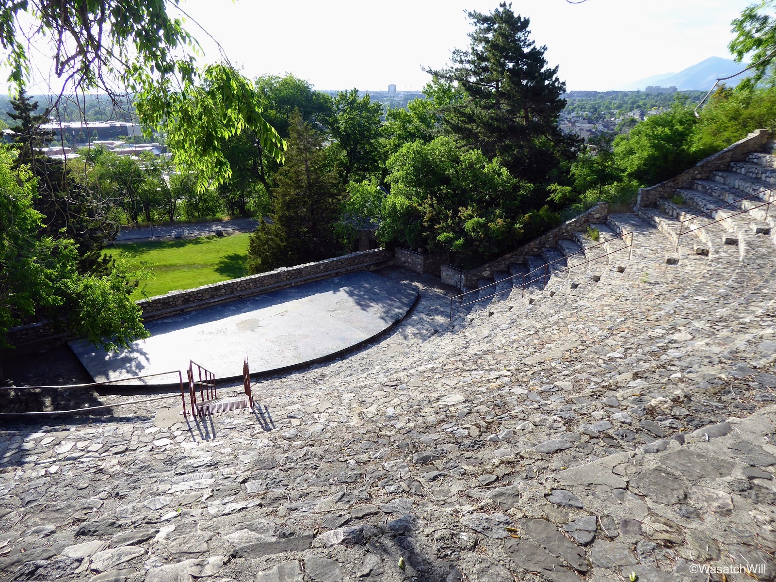
Atop the 'Castle' Amphitheater

Another look across the 'Castle' Amphitheater
I didn't get started until late in the day. This is typical for many of my backpacking adventures. It often works out for the better in the heat of summer though, and this was especially so on the beginning of this hike. I was fully exposed to the sun and there'd be virtually no shade since leaving the hospital grounds for the next couple of miles as I made my way along the Bonneville Shoreline Trail to the Y Trail, the very popular one mile trail up to the large block Y seen from most of Utah Valley.

Bonneville Shoreline Trail toward Y Trailhead with Mount Timpanogos beyond

The Y Trailhead
After a mile of the seemingly endless, shadeless, switchbacks up to the Y, I took more a bit of a rest. The Y is not something I often hike to as a destination in itself as most all others who hike to it do, but rather becomes a brief resting stop as I'm making my way up or down Slide Canyon. In this case, I was on my way up Slide Canyon. The Y is the result of plans to originally construct all three letters of B-Y-U by students of Brigham Young University high up on the mountain side adjacent to the eastern side of the university campus. However, due to difficulties encountered in the construction of the central letter, the "Y", plans to do the other two letters were abandoned. In my opinion, that was probably for the better. The Y itself is very large, measuring out to be 380 feet high by 130 feet wide. Having the additional letters on either side of it would have become overwhelming to look up at.

Looking up from the bottom edge of the Y
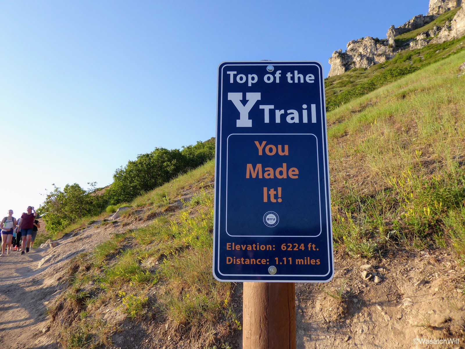
Made it!

Looking down from the top middle edge of the Y
From the Y, I ascended one last switchback up into Slide Canyon before pausing for a more extended break at one of my favorite spots along the trail, a spot known as Eagle Pass. Along the way, there were some Sego Lillies, Utah's state flower, dotting the slopes.

Sego Lilly

Descending Sun from Eagle Pass
Eagle Pass serves as the gateway for the trail entering up into Slide Canyon. Now in Slide Canyon and with the sun now setting, shade became dominant. At various points along the trail, I'd look back to take in the views of the valley I was leaving behind. At one point, I also observed a cave across the canyon that I had not noticed before.

Looking back down to the Valley from Slide Canyon

Observing a cave across Slide Canyon

Close-up of the cave

Sunset from Slide Canyon
The hike up through Slide Canyon was pleasant, but light was now quickly fleeting. Just above Bear Flat, a place I had camped at with scouts from our neighborhood last year, I reached the fork to the Y Summit trail. There, the dark of night had just about settled in for the evening and I pulled out my headlamp to guide me up the final mile, a very steep and strenuous mile, to the top of Y Mountain.

Aspen forest above Bear Flat
The fork to Y Mountain Summit

Fading daylight across the valley
Once there at the overlook over the Valley, I set up camp nearby, placed a call with my wife to let her know I was safely as camp, and settled in for the spectacular views of the valley below, now sparkling and glittering with all of its lights among the nightscape.

View of Utah Valley below from overlook
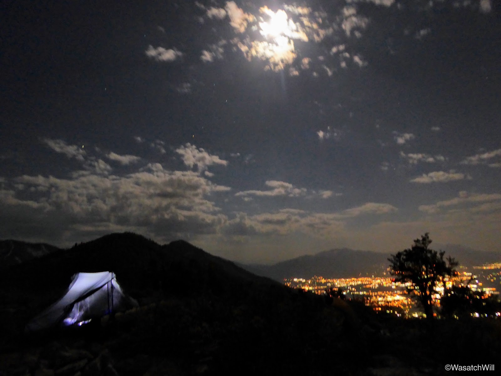
Camp with moon above

Camp with Provo Peak beyond (left)
I had myself a later 2nd dinner--I had eaten my first back at home prior to starting the hike--and retired to bad. Halfway through the night, I awoke to the moon preparing to set across Utah Lake. It was an amazing sight to see how brightly it was reflecting across Utah Lake.

Awaking to moon reflecting on Utah Lake
- Day 2 -
Wednesday - June 7, 2017
Wednesday - June 7, 2017
I awoke to a pleasant and peaceful morning. I enjoyed my breakfast with a view before packing up to head back down into Slide Canyon and ultimately up to another trail junction where I'd set sail for Provo Peak.


Along the way to Provo Peak, I'd pass through another flat, known to some as "Apache Flat", the same site where I'd camped with friends my first trip up to summit Provo Peak, and topped off my water there at its hidden spring. From there, I reached the junction for the trail over to Provo Peak and its more commonly used trailhead. For whatever reason, I didn't take time to shoot any pictures through this section, though I did shoot some video (as seen in the video at the end of the post). Pictures of along these sections can be seen in my previous posts from my first and second hikes up to Provo Peak.
Once passed the forest road, FR27, where the more common trailhead lies, I began the steep and strenuous 1.5 mile ascent up to Provo Peak. I was startled by turned out to be a harmless bull snake hanging out on the trail part way up.

After that, I remained fully focused on the peak above, eager to get up and down as quickly as I could just to get back home as soon as I could. Within the next hour, I was once again atop Provo Peak, at 11,068 feet high. It was my 3rd time up and it was every bit the butt-kicker it was the first time. There was a nice sized cornice still in place across the the eastern side, and as always, the views were enjoyable.


With the highpoint of the trip now achieved, it was time to come down and finish out the loop via Slate Canyon which drains down into my neighborhood. Flowers weren't at their peak yet, but they were starting to come on strong down in the meadows atop Slate Canyon. Palamedes Swallowtail butterflies were out in full force too.


With a considerable distance still to go to reach the trailhead for Slate Canyon and the edge of the neighborhood, I was dismayed to find a bit of graffiti sprayed onto one of the more unique and interesting rock formations higher up in Slate Canyon. It was a point that takes some considerable effort to get to, which means, at least in these parts, those who are intent on tagging nature with their mark are putting in the time and effort to come higher and higher up into the backcountry. Sad.


At last, I reached the Slate Canyon Trailhead which marked the final mile back down into my neighborhood and back to my front door.

Wake-up view

Sunrise

Camp at dawn

Breakfast with a view

Tarptent Notch

Packed up and ready to move on

Caterpillar nest

Mount Timpanogo (above) and Squaw Peak (middle) from Y Mountain

Descending back down into Slide Canyon with Provo Peak (top left)
Along the way to Provo Peak, I'd pass through another flat, known to some as "Apache Flat", the same site where I'd camped with friends my first trip up to summit Provo Peak, and topped off my water there at its hidden spring. From there, I reached the junction for the trail over to Provo Peak and its more commonly used trailhead. For whatever reason, I didn't take time to shoot any pictures through this section, though I did shoot some video (as seen in the video at the end of the post). Pictures of along these sections can be seen in my previous posts from my first and second hikes up to Provo Peak.
Once passed the forest road, FR27, where the more common trailhead lies, I began the steep and strenuous 1.5 mile ascent up to Provo Peak. I was startled by turned out to be a harmless bull snake hanging out on the trail part way up.

Bull snake
After that, I remained fully focused on the peak above, eager to get up and down as quickly as I could just to get back home as soon as I could. Within the next hour, I was once again atop Provo Peak, at 11,068 feet high. It was my 3rd time up and it was every bit the butt-kicker it was the first time. There was a nice sized cornice still in place across the the eastern side, and as always, the views were enjoyable.

Taking in the views from atop Provo Peak

View of Utah Valley from Provo Peak

Mount Timpanogos (top middle) and Lone Peak (top left) from Provo Peak

Cornice on edge of Provo Peak with East Provo Peak (top middle) and Uintas across distant horizon

Looking down eastern ridge to East Provo Peak with the Uintas spanning the distant horizon
With the highpoint of the trip now achieved, it was time to come down and finish out the loop via Slate Canyon which drains down into my neighborhood. Flowers weren't at their peak yet, but they were starting to come on strong down in the meadows atop Slate Canyon. Palamedes Swallowtail butterflies were out in full force too.

Palamedes Swallowtail

Descending down Slate Canyon
With a considerable distance still to go to reach the trailhead for Slate Canyon and the edge of the neighborhood, I was dismayed to find a bit of graffiti sprayed onto one of the more unique and interesting rock formations higher up in Slate Canyon. It was a point that takes some considerable effort to get to, which means, at least in these parts, those who are intent on tagging nature with their mark are putting in the time and effort to come higher and higher up into the backcountry. Sad.

Grafitti high up in Slate Canyon

Looking back up Slate Canyon near the trailhead


I live in the neighborhood just down from Slate Canyon and have in the past hiked up there many times. Last year when I was up there I saw the graffiti and was disgusted that someone would do that in such a wonderful place. I suppose more of it will happen since they built the park at the trail head, which draws more attention to the canyon. I have spent some time on that trail and find that it is a peaceful and beautiful environment to be in.
ReplyDelete