Spanish Fork Peak
Wednesday - June 28, 2017
With over 4600 feet to gain in about 5.5 miles, I knew this hike would not be a walk in the park. I tried to get out earlier in the morning but ended up staying home to help with some things around the house and did not drive out to hit the trail until about mid-morning. The first few miles was mostly uneventful with the trail ascending under the cover of trees shortly after departing the trailhead at Whiting Campground. It would remain under the cover of trees, a green tunnel as it were, for the majority of the next few miles. I couldn't complain about the lack of views. The shade I enjoyed most of the way up on this hot summer day was a luxury to be thankful for, especially with the steep and strenuous elevation gain.
'Green Tunnel'
About 3.5 miles up, the trail finally exited out of the green tunnel for good, leveling off into a beautiful clearing accompanied by a nice breeze that's so common in the higher alpine elevations that makes them such a desired place during the dog days of summer.
Exiting the trees
Shortly after clearing the trees, I found myself on the shores of a very full Maple Lake. It was not big by any means, but it was very full by its own standards with primary trail descending right into the edge of it.
Maple Lake
It wasn't difficult to round the lake and pick up the official trail around the other side. From the lake, I was able to look up and behold the summit of Spanish Fork Peak. I actually stopped with Sophie for a nice break on the shores of the lake to fuel up for the final charge up to the summit.
Zooming in on Spanish Fork Peak
Once past the lake, the views really started to take off.
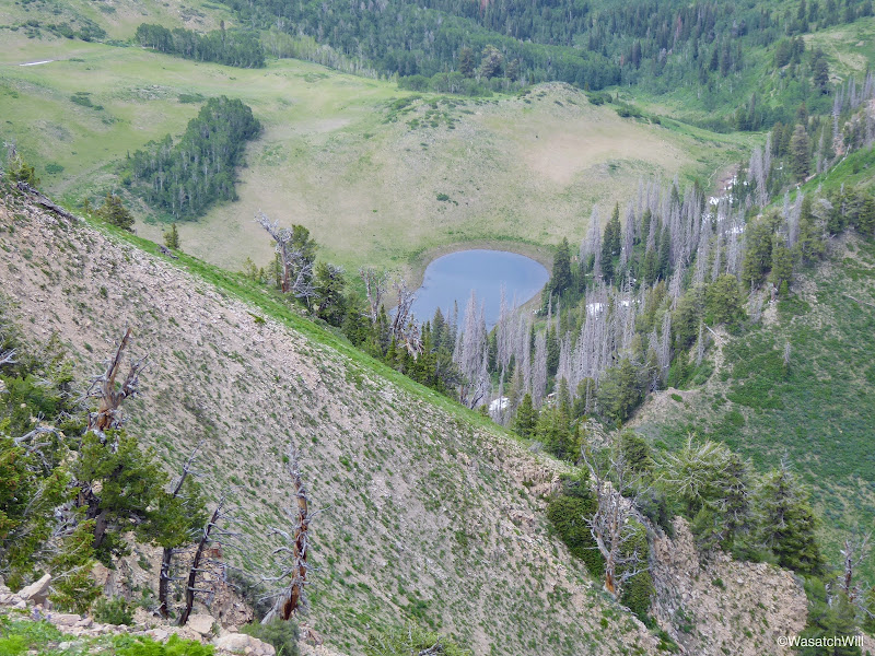
Looking back down at Maple Lake
Trail to the saddle
Looking back down the snow, talus, and scree filled slope
After traversing through some pleasant meadows followed by a slope filled with talus, scree, and snow, and then a set of switchbacks, I reached the saddle and crested the ridge where I could gaze out into Utah Valley.
A view into Utah Valley and Provo Peak block to the north from the saddle
From the saddle, the trail followed the ridge for a bit, but then traversed the west side of it for some time.
The trail along the ridge to Spanish Fork Peak
Eventually, the trail seemingly hit a dead end with large snow bank still packed across the trail. It was exceptionally steep and I had not brought my spikes with me. There happened to be one other guy up there aiming for the peak as well and he helped each other pursue a course steeply up around the outer edge of it until we found a slightly safer place to kick in some footholds to cross over the snow.
The seasonal crux
Once over what would prove to be the crux of the trail at that time, it was fairly smooth sailing all the way up to the peak. There was one other snow deposit to get around shortly before the final ascent up to the peak, but the bypass around it was not nearly as demanding.
Sophie trotting along
Closing in on Spanish Fork Peak
Close-up of Triangulation Marker on Spanish Fork Peak
In due course, we found ourselves on the peak. I chatted with the fellow hiker for a bit up on the peak. He hailed from Alaska and was now working at Sundance. Like me, he was aiming to bag all of Utah Valley's seven most prominent peaks before year's end. He took off shortly after summiting and we bid each other adieux. Sophie and I hung out for a little longer. Her little legs were well worn out from the demanding hike up, so I let her rest up a bit.
The final steps up Spanish Fork Peak
Under the triangulation marker
'Hanging out'
USGS Survey marker
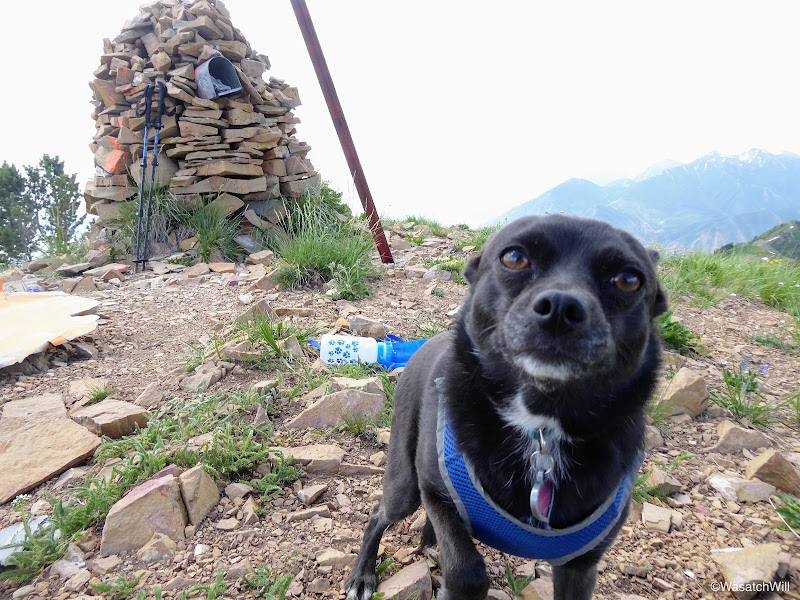
Sophie's 'summit selfie'
Sophie and myself
Spanish Fork Peak triangulation marker and summit cairn
Maple Lake and beyond from Spanish Fork Peak
Close-up of Maple Lake from Spanish Fork Peak
Darker clouds were starting to move in and I had commitments to get back home to in the evening so we stayed no longer and began our descent down. On the way down, I'd bypass the big snow barrier by going around its lower end. It was no less demanding to regain the trail on the other side.
Ready to descend back down
Once back down the eastern side of the ridge, I pursued a course that would allow me to get a little bit of glissading in.
My glissade line
Shortly after the end of the glissade, I rounded the lake descended back down into the tunnel of trees.
Descending back down to Maple Lake
Getting set to drop back down into the trees
The tunnel of trees was briefly broken up by a few meadows and flowers were abundant along the way.
Geranium
Columbine
Columbine
Utah Sweet Pea
At last, I had reached the trailhead where Sophie and I got back into the car for a relatively short ride home. Along the way we'd stop at a convenience store to treat ourselves to some well-deserved beef jerky along with a cold drink for myself.
Creek near trailhead


Leave a Comment